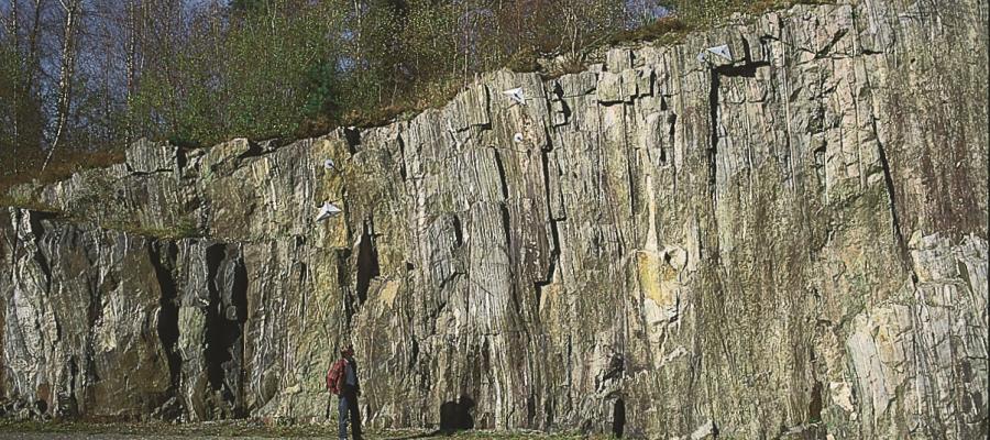
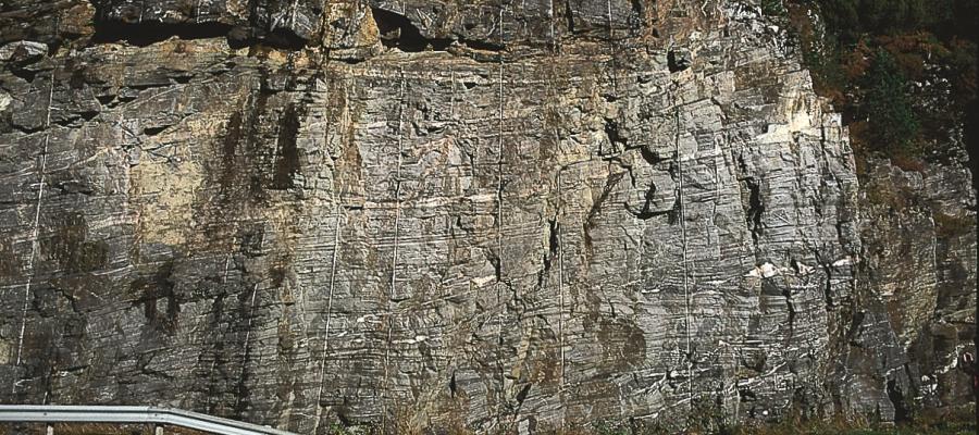
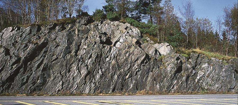
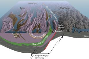
The geology along Oster Fjord and further eastward, in cross-section and on the surface. (Haakon Fossen)

The geology along Oster Fjord and further eastward, in cross-section and on the surface. (Haakon Fossen)

The geology along Oster Fjord and further eastward, in cross-section and on the surface. (Haakon Fossen)

Stall

WHEN THE BERGEN ARCS SANK DOWN

The Bergen Arcs have an unusually sharp boundary to the bedrock in the east. Geologists think that this was caused by movements in the earth's crust during the Devonian Period. Then, the Bergen Arcs on the Lindås peninsula sank a whole 10 kilometres in relation to the Precambrian basement gneisses on the east side of Fens Fjord and Aust Fjord.

The zones of movement follow these fjords. On land, these zones can be observed in the Ostereid and Bjørsvik Bay areas.

The dramatic changes started about 400 million years ago, when the rocks lay at great depth under the earth's crust. At this depth it was so hot that the rock behaved like a viscous dough during the movements. Such zones of movement are called "shear zones" in geological terms; the name of this zone is the "Bergen Arcs shear zone". When the rock was still pliable, it flowed out over what is now the Lindås peninsula, and it sank downwards over millions of years in relation to the basement bedrock to the east.

Through all this time, layer upon layer was removed by the destructive forces in the area, simultaneously as the movements between the Lindås peninsula and the land to the east continued. Through this process, the rock types that originally lay deep down under the crust, came up to shallower depths, so that the temperatures in these rocks cooled. The bedrock therefore grew steadily harder, and that which had earlier been a broad and ductile shear zone, became a narrow and brittle fault. This is how the Fensfjord Fault was formed; the last phase of movement in the region occurred along this fault. Ground up bedrock, which resulted from the faulting, together with the calcite- and quartz crystals, can be found along the sides of the valley north of Bjørsvik. The fault is clearly visible in the landscape as the narrow depression from Bjørsvik over to Stallbotnen.
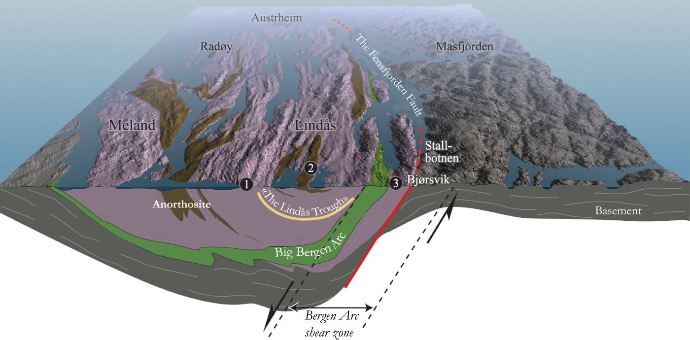
Rørsler i jordskorpa kan skje ved at bergartar blir brotne opp i blokker, skilde av rørslesoner. Dersom fjellet er brote tvert av i ei slik sone, er sona ei forkasting. Har derimot rørsla skjedd djupt nede i jordskorpa, vil bergartane blir strekte som deig og danna ei skjersone.

Bergartane på Lindåshalvøya ligg i ei svær trauform, eller synform. Denne mektige geologiske strukturen grensar til Bergensbogeskjersona i aust. Langs europavegen frå Knarvik til eit stykke forbi Leknes hallar gneislaga steilt mot aust (1), og dei dannar markerte åsrygger og dalar. Langs vegen vidare mot Eikangervågen ligg bergartane mykje flatare (2), noko som viser att i det låge terrenget. I dette området er botnen av den store trauforma passert. Lenger austover mot Romarheim overtek bergartar med lagdeling som hallar mot vest (3). «Lindåstrauet» vart til då berglaga vart pressa saman for kring 400 millionar år sidan. Det er mogleg at denne traudanninga er direkte knytt til rørslene langs Bergensbogeskjersona.

See also

Places in muncipality