First signal station in Solund
The Germans arrived in Steinsund in the summer of 1940. Grey warships docked at the relatively large concrete quay there. They requisitioned rooms in two residential houses and set up a telegraph station in one, until the work had advanced enough for them to move to Husefjellet, which is situated just above the farms.
From the mountain they could watch closely the traffic through the sea-lane of Indre Steinsund, and in addition, they had an unobstructed view of Sognesjøen. The signal station at Tungodden, which was built a short time later, was in view only five kilometres away. The crew at Husefjellet could be 10 - 12.
Transporting up everything was a toil
There are steep rock walls toward the west, also partly toward the north and east. Only from the southeast is the ascent fairly easy. But a number of rocks had to be cut and crude wooden steps built here and there, in order to facilitate the transport in the steep terrain. Everything that was to be moved up the 168 metres, had to be carried on their backs or in their hands: building materials for barracks, bricks, cement, and sand, ammunition, all kinds of fuel, food and drink, etc.. After a year and a half, a driver and a good-looking horse arrived. With packs on its back and sharp shoes, the horse carried most of the commodities to the top, also oats in reward for good work.
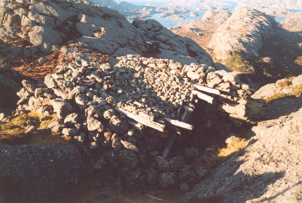
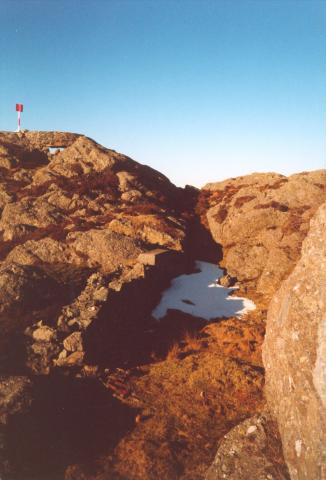
In this depression in the rock, the barracks were located. The stone fence toward the west was built after the barracks, for camouflage and protection toward the south-west. Uppermost to the left is the highest point of the mountain, and there is a remnant of the most important observation post. Those who visited the place after the war was over were surprised by all the board games they must have had, with a whole lot of beautiful glass buttons to move.
Camouflage-painted barracks
The installation on Husefjellet was nearly invisible from the sea. Pushed into depressions and holes were small barracks with various functions. Wherever possible, trenches were dug and stone fences built. Around the whole installation there was barbed wire nailed to trestles, with mine fields under.
In a depression 20 metres south of the summit, the living quarters of four by ten metres was located, with two-storey bunks and a kitchen, divided into two rooms. In an extension of the barracks were built a stable and storage room measuring about 16 square metres. Just north of the barracks there was another building, for weapons, tools, and food.
Under logs and stones
The signal station proper was located ten metres north of the summit, with small windows toward the north and the west. Its base measured three by four metres, built in wood, with a 65-centimetre-thick granite fence around the walls. The roof had a slight curve and thick logs over it, and a thick layer of stone on top. The station could not be seen from the sea, with the exception of a narrow sector from the north. A trench led up to the highest point, where a solid parapet was built with several loopholes for guns. It was quite weather exposed, so a roof and glass walls were required. Parapets were built in stone in several places, which probably also gave some shelter against wind and rain.
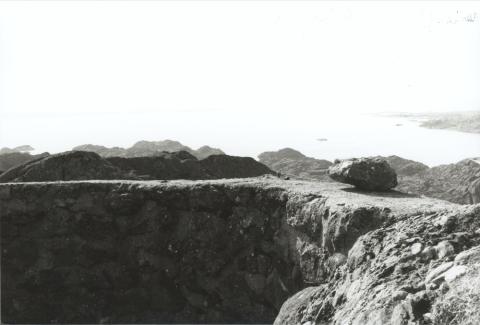
Behind the parapet with a view to the approach of Sognesjøen. To the right there is a glimpse of Tungodden, where there was also a signal station, and perhaps, to the left, it is possible to see the westernmost islands of Gulen.
Agents with radio transmitter close by
Supplies were brought by patrol boats. The guards changed often, many of these seem to have come for rest and recuperation. But merciless Gestapo men came as well to the lookout stations, to tighten up the service.
Their primary task was to report enemy planes and suspicious boat traffic. But in dark nights allied MTBs were able to sail in close by and put agents ashore. At Stokkevågnova, from February, 1944, the radio operators Karl Nesfossen and Eivind Viken lay in hiding and observed the signal station from a three- kilometre distance.
The Germans did no damage to the farm people, and when peace came, they left the station intact. German vessels arrived to clear the mines, not without loss of life.


